Looking for our Sea Kayaking Expeditions?

September 22, 2007

Clark Island to Bellingham!!

9/22/07


Day 89
10 nautical miles


This is it, the bittersweet last day!! Just a regular morning today: alarm goes off at 6:30am, pack the tent, cook breakfast, sip coffee, take down the tarp, jump into the drysuits, carry the gear down the beach, carry the boats down the beach, pack the boats, a quick stretch, and we’re paddling. Mostly sunny with a little traffic in the channel over to Lummi Island. A slow moving tanker with two tugs passes by just as we’re shoving off the beach. We look both ways, smile at each other and dig in to cross our last shipping lane at slack and in good time. It would be a shame to get run over this close to home.

Rounding the north end of Lummi we enter Hale Passage as the flood tide is beginning to push north. Combined with a headwind funneling through the pass we’re slowed to a crawl. It looks like we’ll have to pull hard all the way home, no coasting today.

A flooding tide means that we’re able to get over the “portage” on the north end of Portage Island by paddling through the shallows and this puts us into the water of Bellingham Bay. Native gillnetters are out and about hauling nets and motoring around.

We take a break on Portage, break out the binocs and survey the Bay. Bellingham Bay is notorious for rough, steep waves when the wind is southerly. Today is no exception and Becky and I carefully evaluate the whitecaps speckling the last 4 miles of our expedition. We scan the shore of our home town too, taking in the well-known landmarks: Sehome Hill, the Fairhaven Drydock, the GP site, kites flying at Zuanich Park, clusters of masts in the Squalicum Marina, planes flying overhead making a bee-line for the airport on the bluffs that line the NE edge of the bay. It is all at once familiar and foreign.

In just a few short days Becky and I will be out of our boats and tucked into an outbound flight from that very airport, headed south to our wintery summer in Antarctica. It is nothing short of surreal to contemplate paddling these final 4 miles out of 1300 into that town in the distance where our friends are waiting. We linger on Portage Island, soaking up our last bits of solitary simplicity and savoring the anticipation of reconnecting with friends and family after a three month absence. Only four more miles!

Our break is rewarded with diminishing winds. When we finally push off Portage and aim for Fairhaven the whitecaps have all but disappeared. We’re able to shoot straight across the bay with only the occasional powerboat to worry about. Ever so slowly the landmarks grow to full size and the waterfront comes into sharp view.

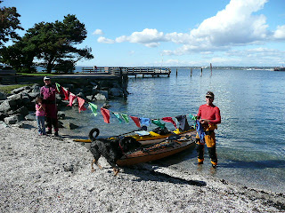
Near the Taylor Street dock we meet the city shoreline and turn to follow the pedestrian walkway towards Boulevard Park. The day has turned sunny and folks are out in force enjoying the last bits of sun before the rains of winter set in.

Becky and I paddle around the dock at the north end of the park and there on the beach are our friends Mary Marie, Emmelina, and Lisiana!! When we catch sight of each other everyone begins cheering and hollering. Our boats glide the last few feet and connect with the beach side-by-side. We’re home. Hugs all around, excited chatter, treats from the picnic basket, questions bouncing back and forth, and more hugs. Becky and I embrace and string out our prayer flags for the obligatory “summit” photo. We look and feel like deer in the headlights! That evening Mary Marie hosts a party in our honor and we’re showered with more congratulations. Lisiana even created a 15’ welcome home banner for us! It is a surreal ending to an unforgettable experience that has expanded our horizons and strengthened our partnership.

Special thanks to Mary Marie and Emmelina for dragging our 50lb resupply boxes to the post office every couple weeks this summer. We would have starved without you!!!
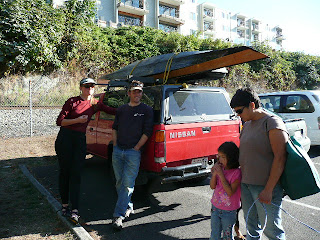
Thank you also to our friends and family, both at home and up and down the Inside Passage, for encouragement, inspiration, and love. This blog is for all of you!

We hope you’ve enjoyed following the adventure!!


More reflections to come…


September 20, 2007

Prevost Island to Patos Island


9/20/07


Day 87


21 nautical miles


Today was one of our longest days in miles and one of our best in terms of interesting paddling. We woke early at 4am and managed to get paddling by 6am. Paddling in the dark was great, calm water and navigational lights flashing everywhere. The ferry landing on Mayne Island looked like a highway on-ramp all lit up and flashing in the distance. Lots of ferry traffic in and out of Active Pass at dawn. Becky tuned in the Vessel Traffic Service on her VHF radio to monitor the ships and hail them if we needed. There is nothing like sharing a small channel with four BC Ferries to make you feel very small, slow, and vulnerable. Now we know what a turtle feels like trying to cross a highway. Thankfully, the visibility was okay.


We continue east along the north shore of Pender Island into a light headwind with overcast skies and light drizzle. At Razor Point we turn north and cross over to Saturna Island aiming for the vineyards snaking up the hill. Yes, vineyards. Dry microclimate perhaps?

During the crossing Becky hollers out, “ORCAS ISLAND!!!” and we spot Mount Constitution looming above Waldron Island in the distance. Home waters are in sight. These are the first familiar landmarks we’ve seen in the 94 days since we left Bellingham! Looks like we just might make it home in time for our flight south to Antarctica on the 27th.

Much of Saturna’s south shore is newly protected as part of the Gulf Island National Park and it is easy to see why. The coast features spectacular sandstone erosion cliffs, terraces, madronas, feral mountain goats, and, remarkably for the Gulf Islands, no houses. The exception to this is East Point, the island’s eastern most finger, a cliffy promontory topped by simple cabins as well as palaces straight out of “Architectural Digest.” Paddling at the base of the cliffs we fight the current and dodge giant reflection waves caused by a freighter headed into Boundary Pass.

The East Point Light marks the last bit of Canadian soil before the border. Becky and I look both ways for freighter traffic, set the GPS, and paddle out into a bit of an ebb current pushing south through Boundary Pass. We’re in a major shipping lane now and waste no time crossing to Patos Island and the good ‘ol USA. Skies are clearing, seas calm, winds light, and, surprisingly, we encounter no shipping traffic in the pass. Yippee!

We pull onto the beach looking hopefully for our friend Glenn from Parkdale, OR. Unfortunately, he’s nowhere to be found, but we do encounter four paddlers from the Seattle area. Dianne and Jerry are paddling Greenland style skeg boats while Jim and Karen are in a double. Becky and I get an invitation to happy hour and dinner and we all share stories of the Inside Passage around the campfire that evening. All evening long we watch a constant stream of freighters and tankers parade through Boundary Pass. We’re disappointed to have missed Glenn, but sharing a sunset and stories with some fellow Washington kayakers is about the best welcome home we could hope for. For the first time in three months we enjoy a sunset reflected off our home waters, the San Juan Islands.


September 19, 2007

Mowgli Island to Prevost Island


9/19/07


Day 86


12 nautical miles


We had a special morning today on Mowgli Island. Our friend, Delphine, used to own the island and built a log cabin there in the 60s. We got permission to stop by and have a look around the place. The new owner has built a palatial island home, but Delphine’s modest one-room cabin still stands and continues to be lovingly maintained as a guest house.

The island is small, “Just a rock” is how Delphine describes it, but a microcosm of the Gulf Island ecosystem: Salal, Gerry Oak, Douglas Fir, Red Cedar, and all sorts of ferns, mosses and grasses.


We won’t be getting to sleep early tonight since there is a giant commercial group sharing our campsite. It is a school group composed of teenagers, teachers, and guides from “Island Escapes”. Shortly after Becky and I set camp their armada paddled in with 30, count ‘em, 30 kayaks, 40 people and an outboard powered support boat. We’re camping tonight in James Bay, which is part of the Gulf Islands National Park. I’m not familiar with National Park regulations in Canada, but being a ranger for the US Park Service myself, I’m appalled that a commercial group of this size would be allowed to operate in a National Park. Twelve or even fifteen people I could understand, but there is no way to justify a group of 40 as anything other than the gross exploitation of wilderness for profit. Besides, smaller groups are easier to manage, afford better opportunities to view wildlife and learn skills, and allow for better client care. Thankfully, the camping area is in an old apple orchard (good apples too!) and there is plenty of space. However, there is no minimizing the impact of a group that size, particularly when they insist on playing games of tag after dark. Even the adults are shouting and carrying on into the night. Ahh, our last night in Canada.


Since this is the first campsite that Becky and I have shared in 86 days of paddling we just shake our heads, laugh, and head out for a sunset hike. The late night affords us both a chance to catch up in our journals and make good use of the earplugs we’ve been carrying.

Okay, I’m done ranting…

Slack in Boundary Pass is around 2pm tomorrow and 17 nautical miles distant, so the alarm is set for 4am. Tomorrow we paddle in the pre-dawn dark!

September 15, 2007

Gear List


Many of you have been asking specific questions about the gear that Becky and I are using on our trip. As you might expect, we need less than we thought. As the trip evolves, so has the equipment. At this point we’ve discarded all the extraneous junk. Here are the essentials that have remained with us through our last resupply.


Boats


Nick is paddling a modified, self built Artic Tern from Pygmy Boats in Port Townsend, WA. Modifications include a day hatch, perimeter deck lines, retractable skeg, graphite bottom paint, reinforced keel strip, and Necky seat and backband. The boat is 17’ long and 23” wide with three watertight compartments and thigh braces.

Becky is paddling a 1997 Nigel Dennis Kayaks Romany Explorer from the UK. The boat is 17’ long and 21.5” wide with a retractable skeg, and day hatch for a total of three watertight compartments.


Paddling Hardware


Werner Ikelos bent shaft paddle


Onno Mid-Tour straight shaft paddle


Spray Skirt


PFD (lifejacket) with hydration pouch


Cockpit cover


Paddling Software


Kokatat Meridian Gore-Tex drysuit with removable hood


Neoprene booties


Neoprene gloves


Kokatat Surfskin skull cap with brim


Long sleeve rashguard shirt


Kokatat Storm Cagoule hooded paddle top


Universal Clothing


3 Pairs socks


Underwear (not telling how many!)


2 midweight capilene longjohns


1 Fleece pants


1 Quick dry nylon pants for camp and town


1 Gore-Tex rain pants


1 Short sleeved capilene tee shirt


1 Long sleeved midweight capiline zip-tee


1 Long sleeved cotton tee for town


2 Expedition weight capilene tops


1 Hooded Primaloft anorak


1 Gore-Tex rain jacket


1 Wooly Hat


1 Visor


1 Headnet


Footwear


Extra-Tuff rubber boots

Neoprene booties


Keen sandals


Safety Gear


6 Red meteor flares (2 in PFD, 4 in boat)


2 Red locator flares in boat


Knife in PFD


Signal mirror in PFD


Whistle in PFD


Tow-line


Pig-tail


Bilge pump


Paddle float


Bailing sponge


VHF Radio


C-Light


Horn (The use-your-lungs kind.)


LED Headlamp


Bear spray


Sunscreen and chapstick


Water Filter w/ spare element


Iodine tablets


Fire starter, matches, lighter


Spare batteries w/ AC charger (DC solar charger died early in trip)


Repair Kits


Leatherman Multi-Tool


First aid kit


Water filter maintenance kit


Stove and pump maintenance kit


Drysuit repair kit (Next time we’ll bring more spare gaskets!)


Boat repair kit


Sewing kit / software repair kit


Plenty of Aquaseal


Camp Gear


MSR Mutha Hubba 3-season, 3-person tent with footprint


Big cheap plastic tarp


Thermarest Trail Comfort sleeping pad (2.5” thick!)


20 degree Dryloft, down sleeping bag


Compressable pillow (yes, a pillow!)


Dry Bags


Kitchen Gear


Black Diamond Megamid single pole, pyramid cook shelter


MSR simmerlite stove (Later we used a borrowed whisperlite.)


2 pots w/ lid and pot gripper


Outback Oven non-stick frypan w/ lid and baking cover


Simmer plate


Folding aluminum stove table


Stove mat made from flameproof fire shelter material


Plastic fold flat “goldfish” bowl


Fillet knife


Spatula


MSR Mugmate coffee filter


Thermos


Waterbottle, 1 Liter


MSR Dromedary watersacks (2x 6 Liter, 1x3L, 1x2L)


Rubbermaid bowl with lid


Mug with lid


Spoon


Fork


Scrubber


Dish soap


Fuel Bottles (2x33oz, 1x22oz, 1x11oz)


Lighters and matches


5 Ursack spectra food storage bags w/ OP-Sack liner bags


50’ bear line with 2 mini carabiners


Navigational Hardware


Deck compass


GPS (used only for long crossings)


PDA with Tide Tool, Coast Pilot, and Sailing Directions


Hand compass


Waterproof binoculars


Large waterproof chart case


Navigational Software


Topo maps (1:250,000)


Nautical charts for AK


Hilson Historical Atlas for AK and central BC


Wild Coast Kayak Atlas for southern BC


Guidebooks (Miller, and Wild Coast)


Tide tables for AK (free!)


Ports and Passes tides and currents for BC and WA


Additional


Toiletries


Fishing gear and license


Natural history guidebooks


Journal and pens


Digital camera with waterproof housing


Prayer flags


Believe it or not, all this stuff fit comfortably in the boats. We even had room to spare for booze and chocolate!

Jedidiah Island to Southy Island


9/15/2007


Day 82


Jedidiah Island to Southy Island


15 nautical miles


Pretty cool day today. Up at 0630 and paddling by 0830. We relaxed and took our time packing up this morning and still got off in two hours. Our efficiency has improved dramatically. A little overcast today, but winds are calm to light SE. Looks like a good day to cross the Strait of Georgia!

Jedidiah Island is a provincial marine park and a popular one at that. Lots of good, deep, sheltered coves with stern anchor tie-offs means lots of cruising boats. Last night, Becky and I took a little hike around the island and stumbled upon another kayaker’s site. The paddler was fast asleep and sawing logs in his/her tent. This morning there is no sign of life from either the yachties or the kayaker. We silently glide away unnoticed.

We cross narrow Bull Passage over to Lasqueti and enjoy paddling around its rugged east end admiring the perched homes. Farther along lies Squitty Cove, a provincial boat haven. The float in the harbor is packed with sailboats. The south BC coast is certainly the land of the sailboat, they almost outnumber the power boats down here. SE Alaska seemed to be dominated by commercial fishing boats, north BC was full of power yachts, and central BC had its charter fishing skiffs buzzing everywhere. As the character of the coast has changed so have the users.


Beyond Squitty Cove the water opens up. We now start our crossing of the Strait of Georgia by hopping over to Sangster Island. Previously flat seas turn slightly bumpy due to a current running in the channel between Sangster and Lasqueti, but the wind is calm. The coast of Sangster turns out to be sedimentary conglomerate sandstone, gone are the rugged granite shores we’ve encountered up to this point.

We leave Sangster and point for North Ballenas Island and the automated lighthouse visible atop the bluff on the north shore. The crossing is only 4.5 miles, but exposed to the entire length of the Strait of Georgia to the northwest and southeast. The seas flatten out as we cross, the wind remains light and we spot nary a tanker, ferry or barge the whole way across. Perfect!


A concern unique to this stretch of water is Whisky Golf, a joint Canadian / US torpedo testing range. The range takes up a significant portion of the Strait of Georgia off the city of Nanaimo, our next destination. Apparently the depth and flatness of the sea floor in this area is perfect for the sonar and hydrophone arrays used in torpedo testing. Our planned course keeps us well clear of the restricted area, but we carefully monitor our drift all the same. While the torpedos aren’t armed during testing, crossing paths with one speeding through the water at 40 knots is something we’d like to avoid.


We land at the old boathouse below the light station for a break and a look-see. The North Ballenas Lighthouse is perched on a bluff with a commanding view of the Strait. The keeper’s house is boarded up and the concrete sidewalks are crowded by blackberry bushes covered in ripe fruit. Becky and I stroll the grounds picking berries, enjoying the view and imagining the joys and struggles of lightkeeping.

A short paddle past a fleet of reefs, rocks and islets brings us to Southy Island and our camp for the night. Southy is a small swatch of public land in an increasingly developed coastline. On the shore, about 1 mile distant, we see nothing but rows of houses. We can even hear the sounds of vehicle traffic and police sirens carrying across the water. The sun and water are as warm as ever and both Becky and I indulge in a swim before a dinner of home-baked biscuits and dehydrated beef stew. An extra ration of grog for the crew in celebration of crossing the Strait!


September 14, 2007

Lund to Harwood Island


9/12/2007


Day 79


10 nautical miles


Leaving town after a rest day is always a challenge. There are always more phone calls that you’d like to make, more photos that you’d like to post, and more beer you’d like to drink. Today our chores got the better of us and we didn’t push off until 3pm. Good thing we had a short day planned.

Harwood Island, off the north end of Texada Island, is a First Nations reserve, so we called the band and obtained permission to camp before we left Lund.

Another sunny day without the drysuit! The coast south of Lund has road access so we’re seeing more and more homes and cottages. We can feel the wilderness disappearing. But at least we no longer have to worry about the bears.

Harwood Island has a long sandy spit off the north end. The spit is topped with nice prairie grass, lots of flat ground, and a 270 degree view! The air is warm and still and the water like glass. Its such a nice day that someone is out tonight wakeboarding without a wetsuit! The Sunshine Coast is certainly living up to its reputation. At sunset Becky and I stroll the beach and watch the sky and sea merge into a bright orange hallucination.

We decide to leave the fly off the tent tonight and are rewarded by an ocean of stars, occasional meteors, and the twinkling lights of Powell River. We can hear the dull roar of the pulp mill despite our distance from the city. Tonight is our first camp with city noises. Indeed, we’re getting closer to home.

September 13, 2007

"So what do you eat out there?"


Believe it or not, we’ve actually been eating quite well on this trip. Here’s what was in our last resupply box which we picked up at Refuge Cove, BC on 9/10/07.


Pasta with sauce – dehydrated

Potatoes with beef and gravy – dehydrated

Assorted soup mixes

Dehydrated chicken

Farina

Corn chowder mix

Couscous

Rice

Pancake mix

Beef jerky

Minced dried garlic

Minced dried onion

Pine nuts

Brown sugar

Pepperoni sticks

Cinnamon and nutmeg mix

Trail mix

Assorted energy bars

Rice krispy treats

Asian trail mix

Assorted teas

Milk powder

Gatorade
Dried apricots

Quaker oatmeal squares

Instant strawberry cheesecake mix

Toothpaste

Multi-vitamins and glucosamine tablets

Hot cocoa mix

Dehydrated beef

Dried mixed vegetables

Olive oil

Topo maps and nautical charts


Yum!!

Of course, since we we’re “in town” when we picked up this box, we just had to raid the general store for some goodies. Becky picked some crackers, Brie and an apple. Nick came out with a candy bar and a can of Pringles! Bring on the calories!

Cape Caution to Lund, Photo Gallery

9/12/07

Day 80

Greetings from Lund on BC's Sunshine Coast

Well, after an epic two weeks of marginal weather, rain, and difficult paddling we've finally turned the corner. The last five days have been crystal clear with tailwinds or no winds, miles have been quick and days short. Our bodies are thankful for the rest and summer-like relaxation. Paddling has been a pleasure after starting to feel like a chore. A week ago we saw our first Douglas Fir and three days ago our first Madrona tree. Out last campsite was a developed BC Park site with an OUTHOUSE! Now, that's civilization.

Today is a bit of a rest and resupply in a town that you can drive to, our first since Prince Rupert. We have about 170 miles and 10-12 days to go until Bellingham and the forecast is for contined high pressure, sun and light winds!! Yippee!!

Here are some highlight photos:


Lining the boats over to our campsite.


Counterbalance food hang to keep our goodies out of Yogi's paws!


A typical misty day on the Inside Passage.
Paddling in Queen Charlotte Strait.
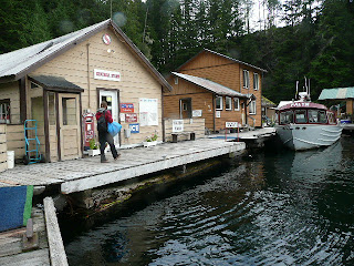
Sullivan Bay, a floating community off North Broughton Island and one of our resupply points.
Cooking up the goodies on Cedar Island, Broughton Islands.
Sailing the kayaks at 6 knots in the strong westerlies of Johnstone Strait!!
Unloading the boats after a short day before running Green Point Rapids.
Estero Peak, Discovery Islands.
Outside Shoal Bay.
Refuge Cove, near Desolation sound and our last resupply point.
Sorting food on the float at Refuge Cove.
Sunset at our site in the Copeland Islands.
Finally, a good feed at the Lund Hotel Pub!
Ahhh, Becky in rapture at our digs in Lund.

Cape Caution

8/31/07

Day 67

Smith Sound (Redsand Beach) to Skull Cove

Cape Caution Crossing

20 Nautical Miles


Ugh! Our most difficult day yet. The alarm started beeping at 4:30am in the pitch dark. After spending several days weathered in by a SE gale, we wanted to get an early start if the weather proved good enough to tackle our most exposed section of paddling yet.

(Its worth noting that during our little weather induced rest day we were again visited by Donna and Barry on "Water Music". We were camped at Kelp Head at the time and wondering if we'd made the right decision by staying put for the day. They welcomed us aboard, fed us breakfast, and then took us for a short sail around the point to have a look at conditions. A large west swell and NE wind chop was turning the rocky coastline to a roiling wall of spray. We'd made the right decision. Later, back inside at anchor, Donna made up a delicious pasta salad and the first beer I'd had in over a week. Oh, its good to have patron saints like Donna and Barry. Thanks for looking out for us!!)

We listened intently to the radio weather forecast. The gale had blown itself out, but there was still a low pressure system lurking offshore and spinning crap off at the BC coast. Winds were forecast to be light in the morning, rising in the afternoon. But the outlook for tomorrow was for strong SE winds, not an improvement. Current conditions at 4:30am at Egg Island Lighthouse, just north of the Cape, were winds NE 7 kts, 1 foot chop, low west swell. Offshore the West Sea Otter Buoy was reading seas 1.4 meters, wind SE 12 kts. Good enough for us to go have a look.


By 7am we were paddling under leaden skies and oily calm seas. We passed out of Smith Sound and into the open Pacific coast to be greeted by rolling swells. The rocky shore and reefs off Hoop Bay were breaking, but by staying offshore Beck and I were able to just ride the rolling seas. Sea lions were playing in the kelp beds and bobbing vertically out of the water to catcha glimpse of the strange humans paddling past. A parade of cruisers and gilnet boats were cruising south about a mile further out from our path. So far, so good.

At Neck Ness we encounter opposing current and are slowed to a crawl. Still making progress we inch our way to Cape Caution. Turning the corner is quite an experience, almost immediately the swell becomed confused, sloppy, and bumpy. A blast of chill air greets us and the neoprene gloves go on. Nature is calling as well, after several hours non-stop in the boats both Becky and I have to GO!! I use a pee bottle while Becky goes through some amazing acrobatics with the boats rafted together. Since we don't want to run the surf breaking on the few beaches on this stretch its the only way.

Around the Cape we're getting the full effect of the swell and the seas increase to monsters, nothing scary or dangerous, just huge and rolling. For me, it was the beginning of the suffering. Big 6' then 8' and finally 10' rollers under the boats. I've never before been seasick in a kayak before, but today was the day. Hammering headache, wretched nausea and nothing to do but keep paddling the next 6 miles until we were around the corner. Down in the troughs of the waves everything disappeared, up on the crest we could see for miles. We both felt very small and insignificant and vulnerable out there.

Eventually, we turn the corner into protected waters and everything goes flat. 20 minutes later we're ashore and we're having a much needed stretch and pee.

7.5 hours of continuous, non-stop paddling got us around the cape with no landings and no drama besides the incredible scenery and a bout of seasickness. Not too bad, but we're both wasted at day's end. Time for a nice long sleep!